30 Mar Webinars on OpenStreetMap for Open-AE and Crowddreaming Projects
30 Mar, 2020
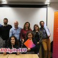
 To celebrate ALL DIGITAL Week, on 24 March 2020, ALL DIGITAL organised two webinars introducing a participatory activity that people can do to be engaged in an open source movement.
Of particular importance to the Open-AE project and its training course is the use of Open data. Open data means you are free to use it for any purpose as long as credit is made.
For the Crowddreaming project, we wanted to encourage teachers who are interested in cultural heritage to find new virtual ways of sharing and documenting their cultural heritage.

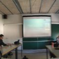
Pia Groenewolt of ALL DIGITAL leading a webinar
OpenStreetMap was founded by Steve Coast in the UK in 2004. The basis for inspiration of OpenStreetMap was the Wikipedia and concern about how prominent proprietary map data was growing around the world. Now more than two million people are registered on OpenStreetMap. Some of the benefits of the maps are how user driven they are. If something is missing on open street maps you can easily add it yourself, and the change is there instantly. OpenStreetMap emphasizes local knowledge. It works faster than google maps for example as the data added to open street maps does not need to be verified by a third party.
Cyclists and hikers enjoy using open street maps as the community sourced maps means public bike lanes, and hiking trails are more easily found. Areas of functional public interest like rest areas or free camp grounds which may not be commercial can be easily added to the map.
The webinar aimed to provide a quick introduction to OpenStreetMap. It showed how you can make edits in open streets maps, how you can actively map neighbourhoods or city areas using the aerial photography mode.
 For the Open-AE participants, special attention was paid to user diaries. In the user diaries users can ask questions and see if items on the map are correct. Or they can also leave a note to another user letting them know that a new road or trail may develop, and when that is ready another user can add it. It is also possible to do this for public transportation routes. Due to the covid-19 crisis, some diary notes were left to try and use OpenStreetMaps to provide support for local communities. There were notes encouraging people to update the contact information and location of essential services like schools so parents can maintain better contact with schools during the crisis.
 For the Crowddreaming participants, an exercise was featured that showd how a monument of cultural heritage significance can be added to the map. The intention was to invite teachers who are taking part in the crowddreaming course to add elements of cultural heritage to OpenStreetMap. This would help people visiting or living in their communities to know more about the area and gain awareness of cultural points of interest.


